檔案:Daito islands en.png
全幅 (微格一四五八矩八八四,度:三二四 KB,多用網際網路副檔名之型:image/png)
概
| 述 |
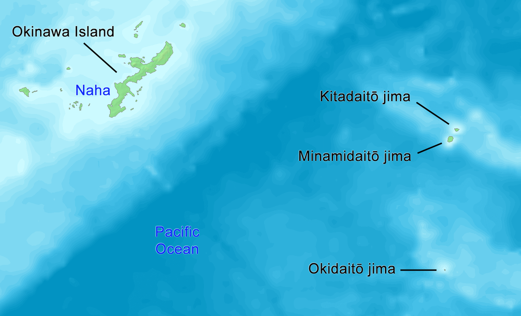
English: Map of Daito Islands (in English).
日本語: 大東諸島の地図(英語)。 |
||||
| 期 | |||||
| 碼 | http://www.demis.nl/wms/mapclip.htm | ||||
| 作者 | Tdk | ||||
| 准 (重用此檔案) |
|
權
| 我,此作品的版權所有人,釋出此作品至公共領域。此授權條款在全世界均適用。 這可能在某些國家不合法,如果是的話: 我授予任何人有權利使用此作品於任何用途,除受法律約束外,不受任何限制。 |
檔誌
揀日尋檔。
| 日時 | 縮 | 度 | 用戶 | 註 | |
|---|---|---|---|---|---|
| 今 | 二〇一九年一〇月一四日 (一) 一四時五八分 |  | 一四五八矩八八四(三二四 KB) | Artanisen | {{en|English: High quality map of the Daito Islands. Created with DEMIS World Map Server.}} {{ja|日本語:高品質の地図、大東諸島。}} |
| 二〇〇八年六月八日 (日) 〇三時五八分 |  | 六一五矩四六一(八七 KB) | Tdk~commonswiki | {{Information |Description={{en|1=Map of Daito Islands.(in English)}} {{ja|1=大東諸島の地図。(英語)}} |Source=http://www.demis.nl/wms/mapclip.htm |Author=Tdk |Date=2008/6/8 |Permission={{demis-pd}} |other_versions= }} {{ImageUpload|full}} |
檔所繫者
下頁連本檔:
總文之用
下他共筆連本檔:
- az.wikipedia.org上之用
- cs.wikipedia.org上之用
- de.wikipedia.org上之用
- en.wikipedia.org上之用
- es.wikipedia.org上之用
- eu.wikipedia.org上之用
- fi.wikipedia.org上之用
- fr.wikipedia.org上之用
- it.wikipedia.org上之用
- ko.wikipedia.org上之用
- lt.wikipedia.org上之用
- no.wikipedia.org上之用
- pl.wikipedia.org上之用
- pt.wikipedia.org上之用
- ru.wikipedia.org上之用
- sv.wikipedia.org上之用
- tr.wikipedia.org上之用
- uk.wikipedia.org上之用
- uz.wikipedia.org上之用
- vi.wikipedia.org上之用
- www.wikidata.org上之用
- zh-yue.wikipedia.org上之用