檔案:West Germany 1956-1990.svg

此 SVG 檔案的 PNG 預覽的大小:寛四五〇高四五六微格。 他晰:寛二三七高二四〇微格|寛四七四高四八〇微格|寛七五八高七六八微格|寛一〇一一高一〇二四微格|寛二〇二一高二〇四八微格。
全幅 (SVG檔,貌有像素四五〇矩四五六,幅四七一 KB)
概


.svg)
.svg)
.svg)
.svg)
.svg)


.svg)
.svg)
.svg)


.png)
.png)


.svg)


.svg)

.svg)


.svg)
.svg)
.svg)
.svg)


.svg)
.png)


.svg)


.svg)
.svg)


.svg)


.svg)


.svg)
.svg)
.svg)
.svg)
.svg)
.svg)
.svg)
_cropped.svg)
.svg)
.svg)
.svg)
.svg)
.svg)
.svg)
.svg)
.svg)
.svg)
.svg)
.svg)
.svg)
.svg)
.svg)
.svg)
.svg)
.svg)
.svg)
.svg)
.svg)
.svg)
.svg)
.svg)
.svg)
.svg)
.svg)
.svg)
.svg)
.svg)
.svg)
.svg)
.svg)
.svg)
.svg)
.svg)
.svg)
.svg)
.svg)
.svg)
.svg)
.svg)
.svg)
.svg)
.svg)
.svg)
| 這是一張修飾過的圖片,即本圖片是用軟體修改過後的版本。原版圖片來源:Blank map of Europe 1956-1990.svg。
|
權
我,本作品的著作權持有者,決定用以下授權條款發佈本作品:
此檔案採用創用CC 姓名標示-相同方式分享 3.0 未在地化版本授權條款。
- 子可:
- 享 – 複製、發佈和傳播本作品
- 重改 – 創作演繹作品
- 惟需遵照下列條件:
- 享 – 您必須指名出正確的製作者,和提供授權條款的連結,以及表示是否有對內容上做出變更。您可以用任何合理的方式來行動,但不得以任何方式表明授權條款是對您許可或是由您所使用。
- 共享 – 如果您利用本素材進行再混合、轉換或創作,您必須基於如同原先的相同或兼容的條款,來分布您的貢獻成品。
原始上傳日誌
This image is a derivative work of the following images:
- File:Blank_map_of_Europe_1956-1990.svg licensed with Cc-by-sa-3.0
- 2011-10-30T04:43:42Z Alphathon 450x456 (485146 Bytes) == {{int:filedesc}} == {{Information |Description={{en|Blank map of Europe showing national borders as they stood from 1956-1990.}} |Source=*[[:File:Blank_map_of_Europe.svg|]] |Date=2011-10-30 04:42 (UTC) |Author=*[[:File:Bla
檔誌
揀日尋檔。
| 日時 | 縮 | 度 | 用戶 | 註 | |
|---|---|---|---|---|---|
| 今 | 二〇一八年九月二八日 (五) 〇一時三一分 | | 四五〇矩四五六(四七一 KB) | FelipeRev | Se incluye Berlín Oeste pero con un color diferente, para marcar que pertenecía a su espacio económico |
| 二〇一五年七月一五日 (三) 〇四時〇四分 |  | 四五〇矩四五六(四七六 KB) | Elevatorrailfan | Breaking apart West Germany and West Berlin paths. | |
| 二〇一四年一二月一〇日 (三) 〇一時四三分 |  | 四五〇矩四五六(四七六 KB) | Elevatorrailfan | West Berlin was not part of West Germany. | |
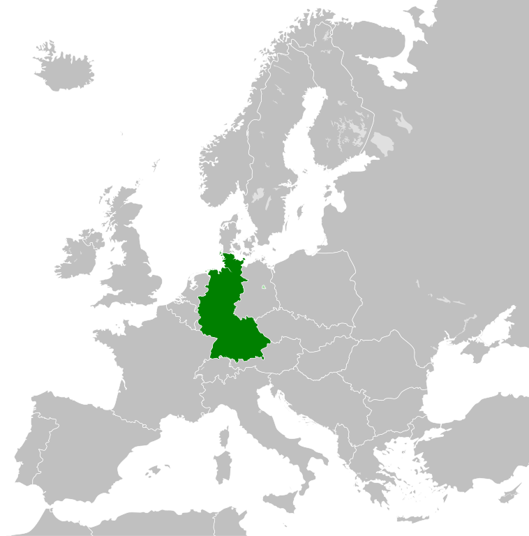
| 二〇一一年一一月二六日 (六) 〇〇時三九分 |  | 四五〇矩四五六(四七四 KB) | StalwartUK | == {{int:filedesc}} == {{Information |Description={{en|Map of West Germany (Federal Republic of Germany) as it was from 1949-1990. Surrounding countries accurate from 1956-1990.}} |Source=*[[:File:Blank_map_of_Europe_1956-1990.svg|Bla |
檔所繫者
下頁連本檔:
總文之用
下他共筆連本檔:
- af.wikipedia.org上之用
- an.wikipedia.org上之用
- ar.wikipedia.org上之用
- ast.wikipedia.org上之用
- be.wikipedia.org上之用
- bn.wikipedia.org上之用
- bs.wikipedia.org上之用
- ca.wikipedia.org上之用
- cs.wikipedia.org上之用
- da.wikipedia.org上之用
- el.wikipedia.org上之用
- en.wikipedia.org上之用
- eo.wikipedia.org上之用
- es.wikipedia.org上之用
- eu.wikipedia.org上之用
- fi.wikipedia.org上之用
- fr.wikipedia.org上之用
- fr.wiktionary.org上之用
- ga.wikipedia.org上之用
- gl.wikipedia.org上之用
- gv.wikipedia.org上之用
- ha.wikipedia.org上之用
- he.wikipedia.org上之用
- hi.wikipedia.org上之用
- hr.wikipedia.org上之用
- ia.wikipedia.org上之用
- id.wikipedia.org上之用
- io.wikipedia.org上之用
- it.wikipedia.org上之用
- ja.wikipedia.org上之用
- ka.wikipedia.org上之用
- ko.wikipedia.org上之用
- ku.wikipedia.org上之用
- lij.wikipedia.org上之用
- lld.wikipedia.org上之用
- lmo.wikipedia.org上之用
- lt.wikipedia.org上之用
- lv.wikipedia.org上之用
- mk.wikipedia.org上之用
- ml.wikipedia.org上之用
- mr.wikipedia.org上之用
- ms.wikipedia.org上之用
檢視此檔案的更多全域使用狀況。