檔案:Southern Leyte mudslide 2006 pic01.jpg
全幅 (微格三二二五矩二一四一,度:四點六一 MB,多用網際網路副檔名之型:image/jpeg)
| 述 |
English: 060219-M-8084P-001 Saint Bernard, Republic of the Philippines (Feb. 19, 2006) - An aerial view of the mudslide, which destroyed the town of Guinsahugon the morning of Feb. 17. Guinsahugon is located in the southern part of the island of Leyte in the Philippines. The photo was taken from a CH-46E Sea Knight which was being flown to Guinsahugon to deliver relief supplies. The helicopter is from the 31st Marine Expeditionary Unit's aviation combat element Marine Medium Helicopter Squadron 262 (Reinforced). The MEU, based out of Okinawa, Japan, is deployed to the Philippines as part of the Forward Deployed Amphibious Ready Group (ARG) based out of Sasebo, Japan and was in the Philippines to take part in exercise Balikatan 2006 before responding to a request for aid by the Philippine government. U.S. Marine Corps photo by Lance Cpl. Raymond D. Petersen III (RELEASED)
Deutsch: Schlammlawine |
||||||
| 期 | |||||||
| 碼 | http://www.navy.mil/view_image.asp?id=32089 | ||||||
| 作者 | Raymond D. Petersen III | ||||||
| 准 (重用此檔案) |
|
||||||

檔誌
揀日尋檔。
| 日時 | 縮 | 度 | 用戶 | 註 | |
|---|---|---|---|---|---|
| 今 | 二〇〇六年二月二〇日 (一) 一二時四二分 | 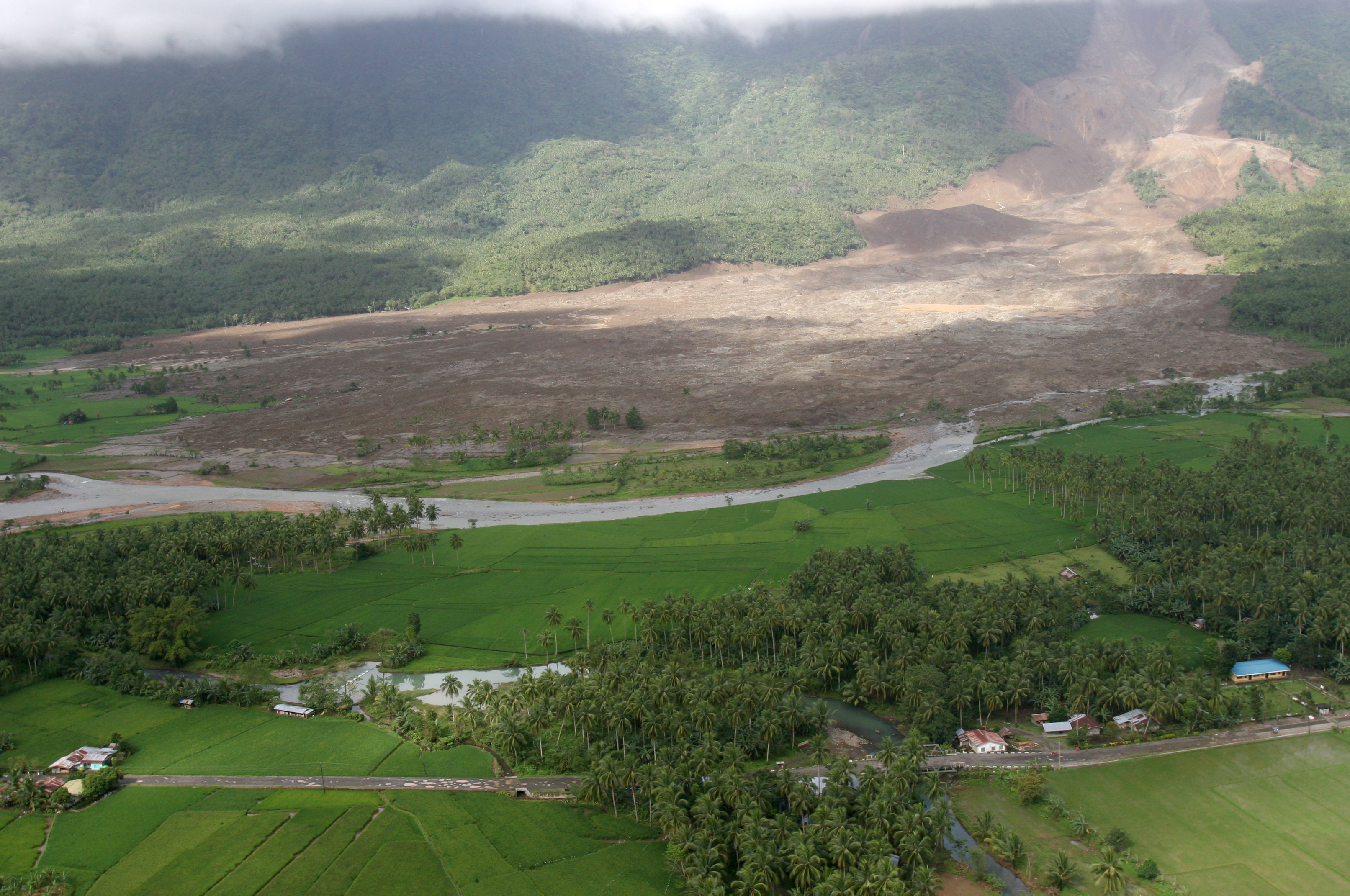 | 三二二五矩二一四一(四點六一 MB) | Stefan Kühn | {{PD-USGov-Military-Navy}} Source: http://www.navy.mil/view_single.asp?id=32089 060219-M-8084P-001 Saint Bernard, Republic of the Philippines (Feb. 19, 2006) - An aerial view of the mudslide, which destroyed the town of Guinsahugon the morning of Feb. 1 |
檔所繫者
下頁連本檔:
總文之用
下他共筆連本檔:
- ceb.wikipedia.org上之用
- de.wikipedia.org上之用
- en.wikipedia.org上之用
- es.wikipedia.org上之用
- fi.wikipedia.org上之用
- fr.wikipedia.org上之用
- hi.wikipedia.org上之用
- id.wikipedia.org上之用
- it.wikipedia.org上之用
- ja.wikipedia.org上之用
- ka.wikipedia.org上之用
- mk.wikipedia.org上之用
- ru.wikipedia.org上之用
- sv.wikipedia.org上之用
- tl.wikipedia.org上之用
- zh-min-nan.wikipedia.org上之用
- zh.wikipedia.org上之用