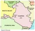
檔案:Kalmykia03.png

覽幅:寛六八〇高六〇〇微格。 他晰:寛二七二高二四〇微格|寛五四四高四八〇微格|寛七三八高六五一微格。
全幅 (微格七三八矩六五一,度:四四 KB,多用網際網路副檔名之型:image/png)
檔誌
揀日尋檔。
| 日時 | 縮 | 度 | 用戶 | 註 | |
|---|---|---|---|---|---|
| 今 | 二〇一二年五月一四日 (一) 一〇時四八分 |  | 七三八矩六五一(四四 KB) | PANONIAN | Reverted to version as of 09:07, 14 May 2012 - trying to fix thumbnail problem once more |
| 二〇一二年五月一四日 (一) 〇九時一八分 |  | 七三八矩六五一(四四 KB) | PANONIAN | Reverted to version as of 09:07, 14 May 2012 - thumbnail problem | |
| 二〇一二年五月一四日 (一) 〇九時一七分 |  | 五七一矩四八七(一四 KB) | PANONIAN | Reverted to version as of 16:09, 29 December 2006 - thumbnail problem | |
| 二〇一二年五月一四日 (一) 〇九時〇七分 |  | 七三八矩六五一(四四 KB) | PANONIAN | improved version | |
| 二〇〇六年一二月二九日 (五) 一六時〇九分 |  | 五七一矩四八七(一四 KB) | Electionworld | {{ew|en|PANONIAN}} Map made by PANONIAN {{PD-user|PANONIAN}} Category:Maps of the Russian republics |
檔所繫者
下頁連本檔:
總文之用
下他共筆連本檔:
- ace.wikipedia.org上之用
- an.wikipedia.org上之用
- ast.wikipedia.org上之用
- bg.wikipedia.org上之用
- bn.wikipedia.org上之用
- bs.wikipedia.org上之用
- bxr.wikipedia.org上之用
- cs.wikipedia.org上之用
- cv.wikipedia.org上之用
- cy.wikipedia.org上之用
- da.wikipedia.org上之用
- de.wikipedia.org上之用
- diq.wikipedia.org上之用
- en.wikipedia.org上之用
- eo.wikipedia.org上之用
- es.wikipedia.org上之用
- et.wikipedia.org上之用
- fa.wikipedia.org上之用
- fi.wikipedia.org上之用
- fr.wikipedia.org上之用
- gag.wikipedia.org上之用
- ga.wikipedia.org上之用
- hi.wikipedia.org上之用
- hr.wikipedia.org上之用
- hu.wikipedia.org上之用
- id.wikipedia.org上之用
- incubator.wikimedia.org上之用
- it.wikipedia.org上之用
- ja.wikipedia.org上之用
- ka.wikipedia.org上之用
- kbd.wikipedia.org上之用
- ko.wikipedia.org上之用
- kv.wikipedia.org上之用
- la.wikipedia.org上之用
- mk.wikipedia.org上之用
- mn.wikipedia.org上之用
- mr.wikipedia.org上之用
- ms.wikipedia.org上之用
- myv.wikipedia.org上之用
- nl.wikipedia.org上之用
- nn.wikipedia.org上之用
- no.wikipedia.org上之用
檢視此檔案的更多全域使用狀況。
