檔案:Map Tosa en.png
全幅 (微格一一八一矩八〇一,度:四三 KB,多用網際網路副檔名之型:image/png)
概
| 述 |
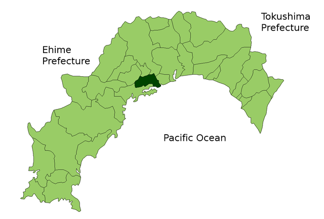
Map of Kochi Prefecture highlighting Tosa city. Borders of map as of October, 2006. (blank map used from [1]) See also Image:KochiMapCurrent.png |
| 期 | 二〇〇六年十月二〇日 (原始上傳日期) |
| 碼 | No machine-readable source provided. Own work assumed (based on copyright claims). |
| 作者 | No machine-readable author provided. Reggaeman assumed (based on copyright claims). |
權
| 我,此作品的版權所有人,釋出此作品至公共領域。此授權條款在全世界均適用。 這可能在某些國家不合法,如果是的話: 我授予任何人有權利使用此作品於任何用途,除受法律約束外,不受任何限制。 |
檔誌
揀日尋檔。
| 日時 | 縮 | 度 | 用戶 | 註 | |
|---|---|---|---|---|---|
| 今 | 二〇〇六年一〇月二〇日 (五) 一二時二六分 |  | 一一八一矩八〇一(四三 KB) | Reggaeman | Map of Kochi Prefecture highlighting Tosa city. Borders of map as of October, 2006. (blank map used from [http://aoki2.si.gunma-u.ac.jp/map/map.html]) See also Image:KochiMapCurrent.png Category:Tosa city, Kochi [[Category:Maps of Kochi prefect |
檔所繫者
下頁連本檔:
總文之用
下他共筆連本檔:
- fa.wikipedia.org上之用
- it.wikipedia.org上之用
- lt.wikipedia.org上之用
- ro.wikipedia.org上之用
- vi.wikipedia.org上之用